

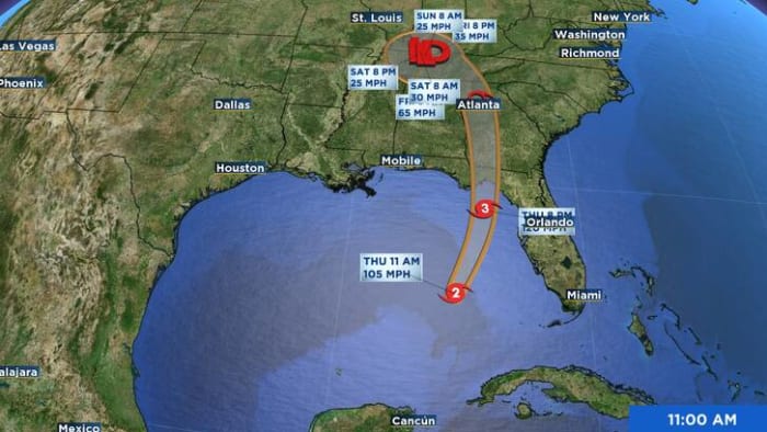
ORLANDO, Fla. – The worst of the weather from Hurricane Helene will take place in the Big Bend, Panhandle region of Florida. As the storm lifts through the Gulf of Mexico, outer bands from Helene will move onshore and push through Central Florida.
Rather than sustained tropical storm conditions, there will be periods of nasty weather as outer bands lash out.
Due to the shear size and wind field of Helene, the winds in Central Florida are expected to crank up starting early Thursday and increasing into the evening hours. Latest models showing wind gusts getting up to 30-40 miles per hour by noon.
The peak wind gusts will be felt late Thursday afternoon through sundown for most of the area feeling wind gusts between 40-50 miles per hour.
When it comes to the rain, scattered showers will spiral into Central Florida through the first half Thursday, with the strongest storms expected to move into Central Florida by Thursday afternoon and into the evening.
The forecast shows a line of strong storms spiraling into the area between 5-7pm, increasing our chance for tornadoes and tropical storm-force wind gusts.
As Helene makes landfall Thursday evening, tropical storm wind gusts will be felt for much of the area along with tropical downpours. The worst of the weather should taper off by sundown on Thursday.
For county-specific impacts, click here to see a full breakdown.
More Stories Like This In Our Email Newsletter


Post comments (0)